We are a 3D capturing & and surveying agency with a primary focus on 3D LiDAR terrestrial and aerial scanning.
We operate in Cyprus, Greece and the UK.
We offer a wide spectrum of point cloud-related outputs such as 2D documentation, 3D models, and Building Information Models (BIM/HBIM).
Our services are suitable for architecture and heritage, industrial sites, offshore installations, vessels, and large-scale urban regeneration projects.
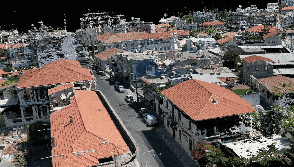
3D Aerial surveys
Urban and land rapid UAV 3D captures.

Heritage archives
Ideal for high fidelity 3D textured models of the existing conditions in heritage and cultural heritage sites and buildings.


accuracy & precision
○ Accurate measurements of objects and environments.
○ Ideal for applications where precise measurements are save time and cost.

safety / accessibility
○ Highly detailed and textured 3D models of environments and sites.
○ Easy data visualization and drawing creation.

cost / time efficiency
○ Quick and efficient captures.
○ Short post-processing durations allow fast transmission of needed data.

versatility and scalability
○ Applicable across many different industries.
○ A valuable tool for a variety of projects and processes.
UAV scanning benefits
powered by


Nicosia, Cyprus / Athens, Greece
+357 99 927768 _ Demetris Ktorides
+357 99 284779 _ Evripides Mytilineos
London, United Kingdom
+44 7 848 890 388 _ Myy Tran
+44 7 463 900 077 _ Mert Ozbolat
info@cloudy.works